 (Images: Google Earth; inset: British Government, public domain)
During the war years of 1939 to 1945, hundreds of airfields were hastily constructed across the United Kingdom. Many were built to accommodate heavy bombers with dozens of hard standings and support facilities. But what happened to these sprawling bases after the war? Some are still in use today, but most have quietly returned to farmland. Often unnoticeable at ground level, they’re betrayed only by dilapidated hangars and the weed-strewn remnants of lonely runways. But from the air, the ghostly imprints of wartime airfields soon reveal themselves – physical reminders of darker days and heroic tales never forgotten. Let’s takeoff on Google Earth and rediscover Britain’s forgotten bases.
Expansion Period Airfields
 (Image: Google Earth)
During the 1930s as the prospect of another war loomed large in Europe, Britain commenced a programme of expansion that saw dozens of high spec airfields constructed, incorporating permanent, brick-built hangars, messes, living accommodation and all manner of support buildings. Some boasted three concrete runways while others utilized grass strips for fighters and light bombers. Most of Britain’s modern air bases and some commercial airfields (such as Teesside Airport – formerly RAF Middleton St George) are upgraded expansion period stations, though many more were abandoned in the decades after World War Two.
 (Images: 97Squadron.co.uk; Youtube; Dave Johnson, reproduced with permission)
Examples include RAF Hemswell, which opened in 1937 as a Bomber Command station operating various aircraft including the Vickers Wellington and Avro Lancaster throughout the war, which saw 122 bombers lost from Hemswell. The base later passed to Fighter Command to accommodate nuclear ballistic missiles during the Cold War. Closing in 1957, it was used temporarily to house Ugandan refugees before disposal to private companies. The married quarters now form a village called Hemswell Cliff, while the hangars, H Blocks and other buildings house an industrial estate which includes Europe’s largest antiques centre. Two short lengths of the original runways still exist, used to park farm machinery.
 (Images: Google Earth)
Other expansion airfields that are now disused (at least in their original guise) include St Eval, Manby, Kirton in Lindsey, Bircham Newton, Syerston and Oakington, to name a few. Like many eastern counties, Lincolnshire alone had 119 wartime airfields. With only around four still active today, that leaves something in the order of 115 abandoned or repurposed. Many of these were satellite stations used only during the war years, dubbed “austerity airfields”.
Austerity Airfields

 (Images: Andrew Wood; Des Blenkinsopp, cc-sa-3.0)
Arguably the backbone of RAF Bomber Command during World War Two, most austerity airfields post-dated the expansion period and were constructed hurriedly between 1939 and 1945 to accommodate the vast numbers of heavy bomber aircraft being produced. They also reflected a departure from more traditional airfields, emphasizing the need to disperse aircraft, hangars and support facilities to increase their chances of survival in the event of attack.
 (Images: Google Earth)
As a result, buildings were spread over large areas and facilities were sparse. Accommodation and even aircraft hangars were often temporary, prefab structures. Land to build them was either requisitioned from farmers or “borrowed” on the promise that it’d be returned after the war. Their temporary nature and often chilly, windswept environment made them austere places, hence the nickname. Hundreds were built, their remains still evident today.
 (Images: Google Earth)
Ironically, the remains of runways, perimeter tracks and hard standings of the short-lived austerity airfields have arguably survived in greater numbers than those of permanent bases. The availability of buildings at the latter have made them ideal for other purposes, and their runways have often been torn-up for road materials. Meanwhile, more isolated locations and private ownership by often single farming families have ensured that many temporary bomber bases throughout Britain have survived, their last prefab buildings used to store agricultural equipment.
 (Images: Google Earth)
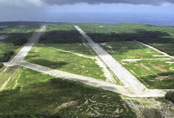
Some runways remain virtually intact while those that don’t often present a ghostly outline of the classic A-frame pattern still visible from the air. Ruined buildings are more sparse than at expansion era stations, but crumbling control towers, Nissen huts, bomb shelters and occasionally surviving corrugated hangars still haunt forgotten airfields. Considering their temporary nature, a striking amount still cling to life.

 (Images: Mick Lobb; Richard Croft, cc-sa-3.0)
The abandoned control tower at RAF Coleby Grange and former hangars at RAF Llandow (above) reflect the many military buildings still evident across the British countryside – historic relics of its wartime past. If you’re exploring at ground level, keep a look out for such structures – it’s amazing how many still survive, especially in the eastern counties of England. Or why not jump on Google Earth and search for the tell-tale A-frame layout of long silenced runways, like those of RAF Brunton (below).


 (Images: Urban Ghosts; Google Earth)
Keep reading – explore Nicosia International Airport (abandoned since 1974), and visit 6 Lost Airfields of the United States.


